Infrastructure for Large-Scale Agricultural Operations
Connectivity, monitoring, and data systems designed for estate-scale land operations in remote regions.
Overview
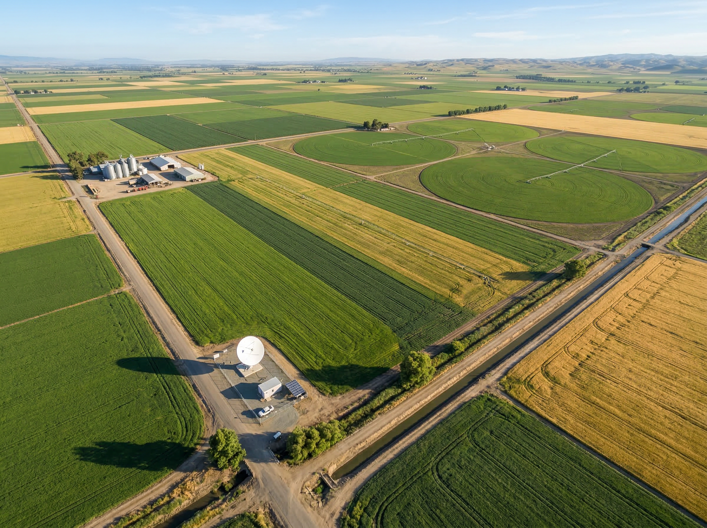
NWNS deploys and supports infrastructure across large agricultural estates and distributed land operations.
What Gets Deployed
Connectivity systems for remote estates — satellite, cellular, and hybrid configurations.
Sensor networks and field data collection — environmental, soil, and operational monitoring.
Irrigation infrastructure and control systems — coordinated through central monitoring.
Remote monitoring and edge systems — solar-powered, field-hardened, and centrally managed.
Remote Sensing & Data
Satellite-based remote sensing for monitoring operations, land conditions, and environmental changes at scale.
Hydrological and groundwater surveys using remote sensing — designed for large-scale water infrastructure planning.
Integration of satellite and field data systems — unified dashboards for estate-scale visibility.
Monitoring of land, water, and operational conditions at scale — coordinated through the central NOC.
How It Works
Step 01
Coordinated through the NOC — planning, logistics, and scheduling managed centrally.
Step 02
Infrastructure deployed across multiple sites and locations within the estate.
Step 03
Local deployment teams install, commission, and test all systems on-site.
Step 04
Structured updates until completion — photo evidence, milestone tracking, progress reporting.
Deployed In
Large-scale operations requiring connectivity, monitoring, and data infrastructure.
Distributed monitoring and control systems across plantation operations.
Infrastructure for irrigation systems, control networks, and water monitoring.
Remote sensing and ground-based data systems for water resource assessment.
One conversation. Full clarity on scope, timeline, and execution.